Friday, July 21, 2017

Revisiting Cow Lakes Lava Flow

Some years ago I made a video of a flight over the Cow Lakes Lava Flow. The camera that I had at the time was only able to record at 480 kbs and the video is grainy. I wanted to do it again with the 1080 Vimeo Camera that I now have.

https://vimeo.com/226399752        password -  owyheeflyer

I increased the air in my tundra tires to 5 lbs. At three pounds it was like trying to land a Pogo Stick. The last video landing I made with them at three pounds had a total of nine different landings on one attempt. I was very glad that I did as I made two landing while I was over there.

We decided to forgo our morning walk today and that gave me a chance to get out a lot earlier than what has become normal. That is good since the later in the morning the higher the wind. I would normally tell you that coffee has no real effect on me other than an occasional bad taste in my mouth, but something was missing this morning. I of course made coffee as soon as I got up, but did all my chores, rolled out and preflighted the plane, setting my coffee on the floor of the plane without ever having taken a sip of it. I taxiied up the hill and stopped to warm the engine. I started looking for the remote to the camera, and couldn't find it. I turned around in a cloud of dust, and started back to the hanger. I called Karen on the radio to bring it out to me. She informed me that the last time she had seen it was around my neck this morning. I found it! Oh well, any body could have made that mistake, right?

The engine reached operating temps, and I took off heading North. As I flew I checked my remote and found that I had forgotten to turn on the video camera. :-/ No problem! I decided to land at the BLM strip at Burns Jct and turn it on. At that point I should have turned around and went back to bed, but didn't. Perhaps I should have taken the time to drink a cup before I left? Oh well, Pobodys Nerfect, right?

After all that, I did "straighten up and flew right". It was a bit slow at ground level and bumpy as well, so I climbed up to about 5000 and the air smoothed and I had a bit of tailwind. There was quite a bit of haze in the sky from a fire in Northern Nevada, and for the first part I was flying right into the sun.

The only wildlife I saw other than Ducks and Geese was three Deer right at the lava flow.

When I got on the other side of the Lava flow I came up to the Jordan Craters Road, and decided that my butt was beginning to cramp. I lined up on the road and set it down. The tires was much better and even though the road was pretty well washboard, the landing was smooth. I didn't realize how much washboard there was until the plane got down to about walking speed, then I could feel it.

After stretching a bit I lifted off and began my return home.


The strip at Burns Jct.


Scott's Butte


 Drifted in Volcano vent


Earlier lava flow


Cow Lakes Lava Flow


Time for a stretch


mouth of the vent


Filled in vent


Pillars of Rome

Saturday, July 15, 2017

Antelope Reservoir

Its been a bit of a struggle to find a reason to go flying this year. I have been every place within my range of area that I can go without refueling at least 20 or more times. So when the weather is so unsettled and the flight window is so small, I generally rationalize the wisdom of staying on the ground. We've had temps over 100 now for several weeks. It has been working on my subconscious for some time that I might be getting old, but I think it just might be laziness.

The windows for quality smooth flight have been really short all spring. We have had little short spells that seem just fine, but when I get into the sky up above the sheltering ridges that surround us, it can be compared to a tumble dryer. The plane can take it, I just don't seem to want it bad enough to make the effort.

I did decide that I wanted to look at Antelope Reservoir a little better than I have so far. We have had a stellar water year, probably the best since our arrival in this area. Yesterday was that day.

 https://vimeo.com/225632176      password-     owyheeflyer

I normally don't take a regular camera with me on most of my flights. Thinking that the video would be enough. I have taken some screen shots off the video as I am editing it, but the size is pretty small. Yesterday I decided to experiment with the camera feature of my Vimeo recorder. It is reputed to be able to take pictures while recording, so I decided to see what they were like. I am a bit underwhelmed, but it was easier.


I had thought to be able to interweave them into my video to enhance the story line, but the video is too long as it is, so here is the next best option.

Monday, July 3, 2017

July 3rd, 2017

The days have been quite hot, threatening to to tip over from the high 90's to triple digits for the last week. It managed to make it to 99 degrees today. Tomorrow should hit 100, and will likely remain that way for the rest of this week. The wind normally comes up in the afternoons, so if I am going to fly, I need to get out early. Dust Devils await those who venture out after one PM. I saw a couple the other day that must have been a 1000 feet in the air. I had to climb up on the roof to make sure that the columns were not smoke.

I wanted to check to see if there was actually anybody actually living in the Teepee that I had seen last week. A neighbor in that area. (20 miles or more away) related that some woman had been staying there last year.  ( It is an indicator of how remote this area is when someone living 20 or more miles away is a close neighbor. ☺) If you will notice there seems to be a shortage of "wimps" residing in this area of the world.  Either that or she is one cranky broad!

There was no one home, and it appeared that the place had been empty for quite sometime. I am guessing, but I don't think she has taken up residence yet this year. With the nearest water about 10 miles away, and 100 degree temps, that seems like a good idea. I got the idea that the area where the Teepee is located might be one of the numerous little private holdings out in the middle of the desert. It is quite amazing but there are a lot of little 5-15 acre plots with no rhyme or reason to them. As I flew over Coyote Lake I saw a small campsite tucked back into a little opening. His dog was up and about, but he was still sitting in his bed. Talk about "unplugged".

https://vimeo.com/224120539  password   owyheeflyer

 ( click the size to 1080, pause it if necessary  to make it run smooth )

Karen and I have been keeping a pretty low profile in this hot weather. July is the hottest month of the year here. It seems that as the days heat up, the heat pulls what moisture there is in the ground and builds thunderstorms, and wind. The friction over the Sage seems to build static electricity, which manifests itself as "Dry Lightening". We have already had a couple of fires so far. The Sunsets and Sunrise's are some small compensation for the phenomenon. I will share them with you.


This particular formation is called "Dumplings"
I have no idea what causes them.


Notice the wind sock. A good strike
will run pretty fast with that much help.


As long as it is only the sky that is on fire.


This one and the next are Sun rises.


You can see the clouds have become too full
of water, and are dumping their load.


The beginning of a new day.

Monday, June 26, 2017

Desert photo's at altitude

I decided that even though I had no place in particular to go, I was going to fly just for pleasure this morning. Storms have been racking the western side of Oregon, and sooner or later the weather was going to turn to crap over here. We were getting indications that the wind would be kicking up by mid day. So after Karen and I had completed our morning walk, I poured a cup of coffee and rolled the plane out of the hanger.

There was a bit of haze to the sky this morning, but I pulled up to 5500 feet, finding a smooth layer of air that suited me just fine. I did have a bit of a head wind but it was constant and still smooth. I decided to see how Coyote Lake was drying out. It has been over a hundred degrees for the last few days. The humidity yesterday was 5 %.


As you can see it has made great strides in the last few weeks. The streak of wet playa right in the middle gives the appearance of a peak rising up out of the lake bed. I assure that it is flat as can be.

I then decided to fly towards the Oregon Canyon Mt's, and Whitehorse Road simply because I had never flown there from Coyote Lake. There is a little two track heading that way from the East end of Coyote lake. I kept seeing a white triangle off in the distance. When I got close enough to make it out I discovered that it was a Teepee sitting there by itself. There was nothing and nobody around it as far as I could tell from 1500 feet above it. I considered dropping down close enough see better, but rejected the idea for later. I assume that it has been there over the winter, perhaps not, but there was no one around, no vehicle or indication of fresh tracks. I had dropped a couple hundred feet of altitude and it got a lot rougher, so I regained and held my altitude.

                                           
                                       There are quite a few Playa pans scattered through this area.


As I turned East I noticed that the wind had given me an extra 25 MPH in speed. The area that I was flying over is one that seems to hold a pretty good sized gathering of Mustangs both winter and summer. There is a permanent water trough that they use. I was high enough that it was difficult to see horses if they were standing still. As I got closer to the playa's I could see a horse standing in the middle of one of them. I kept my altitude but as I got closer I could see that it was a mare with a baby following behind, wading in the playa. The baby was so small that it was hard to see.


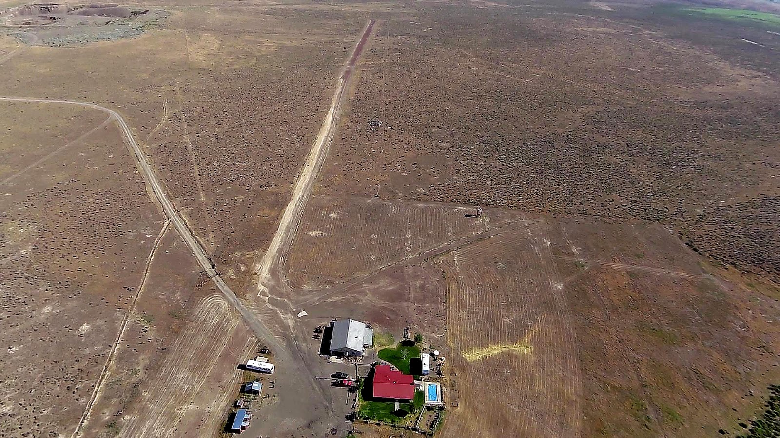
I noticed that KREO, Rome State Airstrip looked pretty good with only a few Tumble weeds growing in the gravel. Its about 100 feet wide and a mile long, and it is about 8 miles south of my house.

I have been told that the State plans to pave it once again so that they can base large water tankers out of there in case of fire. We will see.


I ran a brush hog over the property in preparation for fire season. I even made four passes per side of the runway to cut back the encroaching Sage.


No real guarantee that it will keep us safe from range fire, but you do what you can.  Its not hard to see where the septic leach lines are.


The wind was quite stable out of the SW so I came around to the crosswind runway for my landing. That lovely dark green that you can see bordering this runway is a new growth of Tumble Weeds. They do not sprout until the last of June. I make a serious and expensive effort to kill the growth of weeds both on the place and the runways especially. This pattern with the TW ( Russian thistle) gives me two chances to exercise my spraying equipment.


Tuesday, June 20, 2017

Last day of Spring

Its been a weird year. More rain, snow and wind than seems normal. As they say "The only thing that stays the same, is that every thing always changes". The "normal" spring weather was missing as well, with few days that would lead one to trundle his little airplane out of its snug hangar to get tossed around the sky.


The weekend was stormy with rain, and last night there was a early dose of lightening that was rocking the sky to the North. Happily it was accompanied with rain so there were no columns of smoke this morning. It was far enough away that we couldn't even hear the thunder, but the light show was pretty spectacular.

I got up early this morning, and Karen and I did our runway walk. When we got back I checked the wind forecast. It wasn't all that bad, but was supposed to come up in the noon time frame. I eventually ran out of excuses and rolled the plane out so that I could check the river conditions for a possible fishing trip.

The air was actually pretty nice and I fear that I am in danger of becoming a wuss, so I resolved to do a bit better in the future.

https://vimeo.com/222426663   password-     owyheeflyer

There is feature with these Vimeo  videos that will try to match video quality with your down load speed. The video is uploaded at 1080 highest quality. This gives a video that is sharp enough to actually see some features of the landscape. You can change the speed it is playing by clicking the HD letters. It will show that it is on the "auto" setting.  I always click 1080. If it gets a bit jumpy by stopping, you can click on it to start the video, then pause the playback until the video gets far enough ahead to run smoothly. Depending on your down load capabilities it is well worth the wait. At least it is for me.


Thursday, June 1, 2017

Flight to Big Grassy

https://vimeo.com/219800134    password -        owyheeflyer

This is a flight to Big Grassy which is about 39 miles to the East of the house. I flew high for a change in the hopes that the bigger view would be better. Unfortunately it was a bit hazy and the camera isn't capable of cutting through all of it. Again I was struck with how much water there is every where. The Cheat grass is maturing and every thing is turning red. The foliage at the higher altitudes is a little slower to mature, and therefore greener.

The air was quite smooth so the video is sped up 2.25 times faster than my little plane flies. Its a little jerkier, but you get to see more of the country that way. There is an annoying flutter to the sound track that I could not find or eliminate- sorry!

I once had an acquaintance that scolded me for making the feral horse's run with my plane. That in turn annoyed me enough that I no longer correspond with him. The reason that it bothered me so much is obvious in this video. I am at least a thousand feet above the horses, but they still ran like hell for the rougher country. Perhaps my motor sounds similar to the copters that they use to herd them with.