There was a bit of haze to the sky this morning, but I pulled up to 5500 feet, finding a smooth layer of air that suited me just fine. I did have a bit of a head wind but it was constant and still smooth. I decided to see how Coyote Lake was drying out. It has been over a hundred degrees for the last few days. The humidity yesterday was 5 %.

As you can see it has made great strides in the last few weeks. The streak of wet playa right in the middle gives the appearance of a peak rising up out of the lake bed. I assure that it is flat as can be.
I then decided to fly towards the Oregon Canyon Mt's, and Whitehorse Road simply because I had never flown there from Coyote Lake. There is a little two track heading that way from the East end of Coyote lake. I kept seeing a white triangle off in the distance. When I got close enough to make it out I discovered that it was a Teepee sitting there by itself. There was nothing and nobody around it as far as I could tell from 1500 feet above it. I considered dropping down close enough see better, but rejected the idea for later. I assume that it has been there over the winter, perhaps not, but there was no one around, no vehicle or indication of fresh tracks. I had dropped a couple hundred feet of altitude and it got a lot rougher, so I regained and held my altitude.

There are quite a few Playa pans scattered through this area.

As I turned East I noticed that the wind had given me an extra 25 MPH in speed. The area that I was flying over is one that seems to hold a pretty good sized gathering of Mustangs both winter and summer. There is a permanent water trough that they use. I was high enough that it was difficult to see horses if they were standing still. As I got closer to the playa's I could see a horse standing in the middle of one of them. I kept my altitude but as I got closer I could see that it was a mare with a baby following behind, wading in the playa. The baby was so small that it was hard to see.

I noticed that KREO, Rome State Airstrip looked pretty good with only a few Tumble weeds growing in the gravel. Its about 100 feet wide and a mile long, and it is about 8 miles south of my house.
I have been told that the State plans to pave it once again so that they can base large water tankers out of there in case of fire. We will see.

I ran a brush hog over the property in preparation for fire season. I even made four passes per side of the runway to cut back the encroaching Sage.
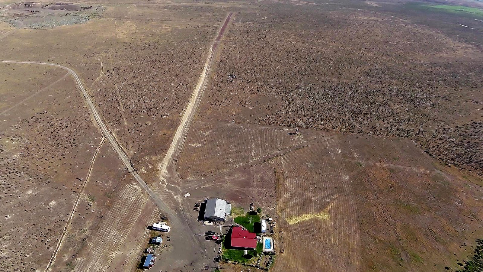
No real guarantee that it will keep us safe from range fire, but you do what you can. Its not hard to see where the septic leach lines are.

The wind was quite stable out of the SW so I came around to the crosswind runway for my landing. That lovely dark green that you can see bordering this runway is a new growth of Tumble Weeds. They do not sprout until the last of June. I make a serious and expensive effort to kill the growth of weeds both on the place and the runways especially. This pattern with the TW ( Russian thistle) gives me two chances to exercise my spraying equipment.